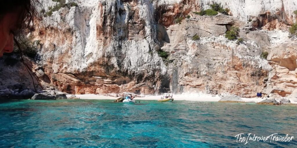
Last visit: August 2020
How to get there: fly to Cagliari or Olbia, then drive to Cala Gonone (roughly 3 hours from Cagliari, 2 hours from Olbia) or to Santa Maria Navarrese and Arbatax in the south. There is no coastal road. There are no coastal towns. This is not an oversight.
Best time to visit the Gulf of Orosei: June, and September. The sea is colder in June, warmer in September; both in June and September the boat tours are bookable on the day, and the parking lots at the trailheads are not managed by someone in a fluorescent vest waving you into a queue.
My rating: 9/10
The Supramonte is a Jurassic limestone plateau in the centre-east of Sardinia, roughly 35,000 hectares of karst highland averaging 900 metres above sea level. Underneath it runs the Codula di Luna, Italy’s largest underground river system, seventy kilometres of tunnels that have been dissolving the rock from the inside for millions of years. At the eastern edge of the plateau, the limestone simply stops, and drops into the Tyrrhenian Sea in vertical cliffs of up to 400 metres. No transition. No coastal plain. The mountain ends, and the sea begins.
The result is thirty-odd kilometres of coastline with no roads, no buildings, no infrastructure of any kind except a few boat jetties at either end. The beaches at the bottom of those cliffs, Cala Goloritzé, Cala Mariolu, Cala Biriola, Cala Sisine, Cala Luna, can be reached by boat from Cala Gonone in the north or from Santa Maria Navarrese and Arbatax in the south, or, if you are very fit, on foot via trekking routes that descend through the scrub and the limestone canyons. There is no other way in. The geography enforced the protection before the legislation arrived, and the legislation arrived in 1998 when the area became the Parco Nazionale del Golfo di Orosei e del Gennargentu, Sardinia’s largest national park at 74,000 hectares.
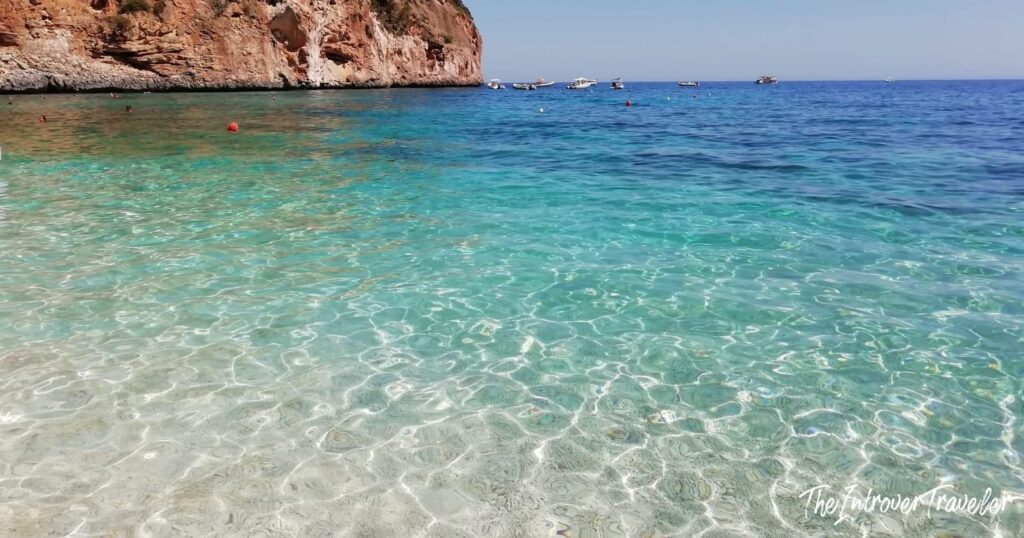
The water is the colour it is because of the karst. Freshwater springs emerge from the limestone seabed, cold and transparent, and mix with the sea in a way that produces a layering of refractive indices you can see with the naked eye: bands of slightly different turquoise, one below the other, each a degree colder than the last. At Cala Goloritzé in particular, swimmers regularly encounter temperature drops of ten degrees within the same cove. It is not unpleasant. It is, however, startling.
Disclaimer: This post does not do these places sufficient justice, but I believe the Gulf of Orosei, together with La Maddalena and Villasimius, is one of the most astonishing places in Sardinia, and indeed in the world, if you are looking for breathtaking seascapes. The photos in this post fall below the minimum quality standard I try to maintain for images on this blog, but when I was in Orosei I only had my GoPro with me, and I salvaged the few available shots from my wife’s phone. I believe the beauty of these places is such that it remains eloquent even when photographed like cr…
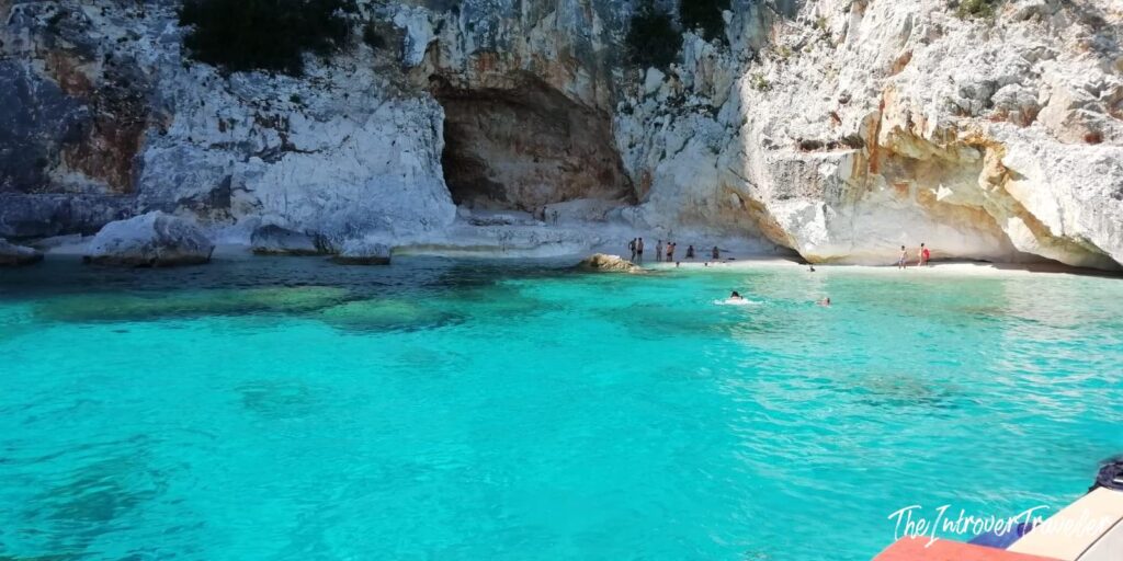
Cala Luna
Cala Luna is the most accessible beach on the gulf and, predictably, the most visited. An 800-metre crescent of pale sand, named for its shape, at the mouth of the Codula di Luna river. Six large caves open into the cliff behind the beach, spacious enough to shelter from the midday sun, cool enough in August to feel genuinely restorative.
By boat from Cala Gonone the crossing takes about half an hour. On foot, the most straightforward route begins from Cala Fuili, the last beach on the Cala Gonone road accessible by car, and follows the trail through holm oak and juniper for roughly two hours one-way. The combination, in by foot and out by boat, is the sensible option and the one most locals recommend: you see the coast from above on the way down, swim for as long as you like, and catch one of the afternoon boats back without retracing the climb. The last boat from Cala Luna leaves around 18:30 in high season; check the time before committing to this plan.
Cala Luna has a kiosk. It is usually crowded by eleven in the morning and significantly less so after four in the afternoon, when the day-trippers depart. If you are arriving by boat and have any flexibility, time your arrival for mid-afternoon.
Cala Goloritzé
Cala Goloritzé did not exist until 1962, when a section of the limestone cliff above the cove detached and fell into the sea, creating the beach in a single event. The landslide also produced Punta Caroddi, the 143-metre limestone pinnacle that stands above the southern end of the beach and is now one of the most celebrated climbing destinations in Europe. The first ascent was made by the climber known as Manolo in the early 1990s; there are now more than ten routes on the needle, ranging from 5c to 7a. You can watch climbers on the upper sections from the water below, which is either inspiring or vertiginous depending on your perspective.
In 2025 Cala Goloritzé was named the best beach in the world by the World’s 50 Best Beaches ranking. Whether or not you take such lists seriously, the recognition prompted a sharp increase in visitor numbers and a corresponding tightening of access management; in high season a reservation is now recommended for the hiking trail.
The access rules here are stricter than at any other cove on the gulf. No motorised boats may enter the cove; you anchor offshore and swim in. There is an entry fee of around six euros per person for the hiking access, collected at the trailhead at Su Porteddu near Baunei. Daily visitor numbers are capped. The hiking trail descends 3.5 kilometres from the car park and takes roughly 90 minutes down and two hours back up. Bring water; there is nothing on the beach.
What you find at the bottom justifies all of it. White pebbles rather than sand, because the beach is geologically recent and the limestone has not yet been ground fine. An arch of rock rising sixteen metres above the waterline that you can swim through. Cliffs of 500 metres on three sides. Underwater springs that drop the temperature suddenly and inexplicably. Fish so accustomed to swimmers they eat from your hand.
This is truly an amazing place.
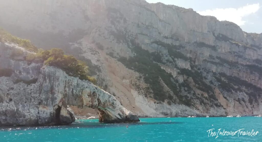
Cala Mariolu
Cala Mariolu divides naturally into two halves: one sandy, one pebbly, the pebbles white and pink from the same mix of limestone and marine organisms that colours Budelli’s famous beach. It sits between Cala Goloritzé to the south and Cala Biriola to the north, reachable only by boat or by the descent routes of the Selvaggio Blu. It is consistently ranked among the five most beautiful beaches in Italy, which means it is also consistently crowded in July and August. In June and September it is exceptional without qualification.
The snorkelling along the cliff base north of Mariolu is some of the best in the gulf: gorgonians, groupers, and the occasional octopus in crevices shallow enough to reach without fins.
Cala Sisine and Cala Biriola
Cala Sisine sits at the mouth of a canyon that was once a river bed; the valley behind the beach still holds a narrow strip of woodland that looks entirely out of place against the limestone walls on either side. The beach is wide and, relative to Cala Luna and Cala Goloritzé, receives fewer visitors. It can be reached by boat from either end of the gulf, or by a long but manageable descent from the Golgo plateau above Baunei, one of the easier approaches on this section of coast.
Cala Biriola is smaller, pink and white pebbles over very clear water, not often included in the standard boat tour itineraries, which is partly why it remains one of the less overrun beaches on the gulf. If you have a private boat or are on a charter that allows you to choose your stops, put Biriola on the list.
The Grotta del Bue Marino
Two kilometres north of Cala Luna by sea, accessible only by boat from Cala Gonone, the Grotta del Bue Marino is the public-facing entrance to the Codula di Luna karst system. The name means sea ox cave. The monk seal, which Sardinian fishermen called the bue marino for its round shape and placid temperament, used the cave as a breeding ground until the mid-1970s, when the combination of fishing pressure, tourism, and general Mediterranean habitat destruction drove it from the coast. The species is now functionally extinct in Italian waters, possibly alive in very small numbers elsewhere in the Mediterranean.
The accessible section of the cave runs for about one kilometre and is guided, mandatory, roughly one hour, no photography permitted. Five chambers, stalactites and stalagmites, underground lakes, and at the end a subterranean beach of fine sand where the fresh water from the karst system meets the tidal salt water: the Spiaggia delle Foche, the Seal Beach, where the monk seals bred. No seals now. Just the beach, the water, and the sound of the system breathing.
The cave tour is purchased separately from the boat crossing; both are available at the Cala Gonone harbour. It is a worthy detour but calibrate expectations: this is not Frasassi or Castellana in terms of geological spectacle. The Bue Marino cave is interesting primarily for what it represents, the karst architecture of the Supramonte meeting the sea, and for the Spiaggia delle Foche, which is one of those places that is quietly devastating if you know what used to happen there.
Personally, I visited the Gulf of Orosei by renting a boat with a skipper from Cala Gonone; along the way, as far as Cala Goloritzè and back, we also had a look at the Bue Marino Caves, without getting off the boat or going inside.
Pedra Longa and Santa Maria Navarrese
At the southern end of the gulf, near Santa Maria Navarrese, a limestone pinnacle called Pedra Longa rises 128 metres from the sea at the foot of a cliff. There is a small car park and a road that reaches the base. It is the only point on the southern gulf coast accessible by land, which makes it the most photographed landmark on this stretch of coast and a useful orientation point for understanding the scale of the cliffs above it. The Selvaggio Blu begins a short distance north of here.
Santa Maria Navarrese is the nearest town to the southern end of the gulf: a quiet resort with boat excursions departing for Cala Goloritzé, Cala Mariolu, and the other coves to the north. It is a calmer and less touristically saturated base than Cala Gonone, though with proportionally fewer facilities.
The Selvaggio Blu
The Selvaggio Blu, the Wild Blue, is the trekking route that runs along the cliff tops between Santa Maria Navarrese and Cala Gonone. It was conceived in 1987 by the photographer Mario Verin and the architect Peppino Cicalò and follows the ancient paths of shepherds and charcoal burners through country that has no infrastructure, no waymarking to speak of, limited water sources, and sections requiring climbing and abseiling at up to grade IV. It takes between four and seven days depending on the itinerary and the group. It is generally described as the most difficult trekking route in Italy.
This description is not exaggerated for marketing purposes. The route requires navigation in dense maquis where the paths are old and not maintained, a rope and abseiling competence, the ability to carry multi-day water supplies in summer heat, and the willingness to bivouac in caves or on cliff edges with no mobile signal. Guided groups with UIAGM-certified alpine guides complete it successfully every season; independent parties without trekking experience in unmarked terrain get into serious difficulties regularly.
That said, sections of the route between Pedra Longa and Cala Sisine can be walked by experienced hikers over four to five days with a guide, and the boat transfer back from Cala Sisine or Cala Luna covers the return. It is an experience of an order entirely different from anything the boat tours provide. The coast looks different from 400 metres above it.
Practical Notes
Base: Cala Gonone is the main hub, a small tourist town below the road that comes down from Dorgali. It has hotels, restaurants, a functioning port, dive centres, and all boat tour operators for the northern gulf. It fills quickly in July and August; June and September offer essentially the same facilities with fewer people. Santa Maria Navarrese is the southern alternative, quieter, smaller, and closer to Cala Goloritzé.
Getting around the gulf: the boat is the primary vehicle. The daily excursion boats from Cala Gonone cover the full length of the gulf with stops at Cala Luna, Cala Sisine, Cala Mariolu, and Cala Goloritzé; these are efficient, well-organised, and include English-speaking narration. For independent access to specific coves, private charter boats are available from both Cala Gonone and Santa Maria Navarrese; a skipper-guided half-day or full-day allows you to stop where you choose and stay as long as you want (as I said, this was my option, and I recommend it).
The trekking approaches: most of the main coves have at least one hiking descent from the plateau above. The route from Cala Fuili to Cala Luna (roughly 2 hours) is manageable for fit walkers with proper footwear. The descents to Cala Sisine from the Golgo plateau, and to Cala Goloritzé from Su Porteddu, are longer but not technical. All other inland routes require either experience or a guide.
Diving: the underwater landscape at the base of the limestone cliffs, including collapsed arches, caves, and submarine canyon walls, is among the best in the central Mediterranean (according to those who tried; it’s still on my bucket list). Dive centres operate from Cala Gonone with a full range of guided dives along the gulf; visibility regularly exceeds twenty-five metres in calm conditions.
The Wertmuller connection: for the record, this is the coastline Lina Wertmuller used for Travolti da un Insolito Destino nell’Azzurro Mare d’Agosto in 1974. Cala Luna, Cala Mariolu, and the dunes of Capo Comino to the north all appear in the film. The coast looked then as it looks now, which is either a remarkable fact or a reminder that the absence of roads is the most effective preservation policy ever devised.